
Madison Neighbors Across Public Records
No official source publishes every person on a Madison block. The strongest starting point is spatial: identify the nearby parcels, then inspect the matching county assessment records. Voter information adds a limited registration layer. Park names and Neighborhood Watch contacts help identify community context, but neither proves an HOA boundary or a household roster.
| Madison Source | Block-Level Evidence | How to Reach It |
|---|---|---|
| City parcel map | Adjacent parcel geometry, address, PIN, and neighborhood field | Free city map and service |
| County assessment | Owner, mailing and situs addresses, value, and exemption | Free portal and public counter |
| Voter list | Permitted voter fields tied to an address | Paid file with statutory protections |
| Neighborhood parks | Official place names, not HOA lines | Free city parks information |
| Neighborhood Watch | Community contact path, not a captain roster | Madison Police at 256-772-5658 |
The assessment roll proves who is listed for tax purposes. A matching homestead exemption and mailing address may support owner occupancy for that tax period, yet neither conclusively identifies the people inside a home. Renters, relatives, and other household members are not indexed in one public Madison directory. Treat each result as a source-specific fact.
Map a Madison Neighbors Block
The Madison County parcel viewer offers By Attribute and By Shape search tabs. Its visible tools include Layers, Legend, Search, Print, Measurement, Street View, and Markup. Attribute searches accept Parcel Number, PIN, Property Address, or Subdivision, with minimum character rules. A result identifies the PIN, tax year, and property address.
- Search the known address and zoom to the matched parcel. Keep parcel layers active so each nearby polygon stays visible.
- Pan around the immediate block or use By Shape. Record each adjacent PIN or parcel number rather than relying on labels alone.
- Transfer each identifier to assessor detail. Compare property address, owner, mailing address, exemption, neighborhood, subdivision, lot, and block.
- Mark facts as owner evidence or residence clues. Do not turn either category into a claim about a whole household.
This process is deliberately local to the immediate ring of lots. A full road-length chain belongs in the Madison street directory, where address records are followed along the named street.
Note: The city parcel service supports spatial and distance queries, but no public button labeled as a radius or buffer tool was verified.
Read Madison Block Records Carefully
Madison's city and county parcel services expose much more than an owner label. The city parcel layer can return Property Owner, Previous Owners, Account Owner, Property Address, Mailing Address, PIN, Parcel Number, Tax Year, Tax District, Neighborhood, Subdivision, Lot, Block, acreage, values, and deed references. Its geometry can support distance and advanced queries.
| Field | Safe Block-Level Use |
|---|---|
| Property address | Places the parcel on the block |
| PIN or parcel number | Transfers the map hit to tax detail |
| Owner and account owner | Identifies assessed ownership, not all occupants |
| Mailing address | Shows where tax mail goes |
| Neighborhood and subdivision | Adds assessment context, not an HOA roster |
| Deed book, page, and date | Points to the recorded transfer |
The Madison GIS REST catalog is shown below. It carries city-limit, parcel, voting, flood, zoning, aerial, and both-county parcel services.
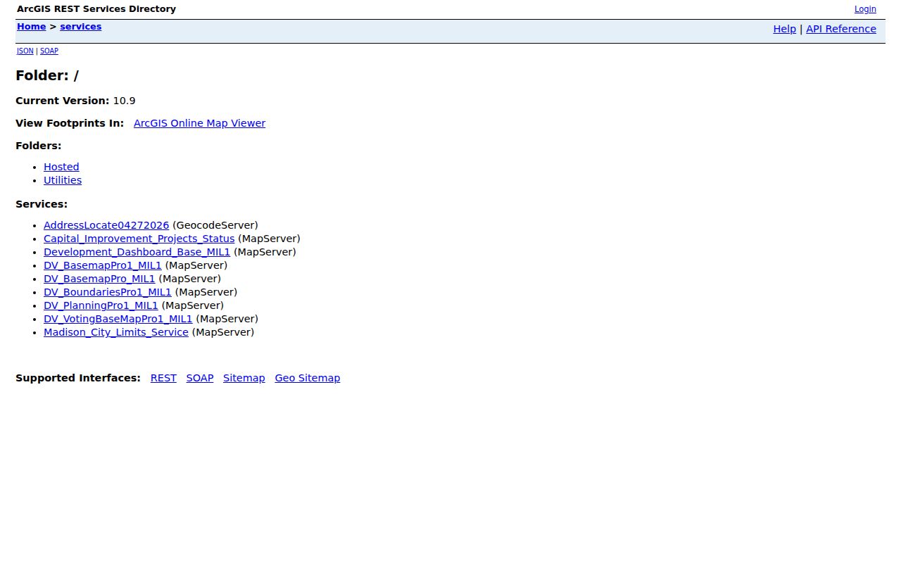
The catalog helps establish geometry and jurisdiction when a consumer map is hard to use. County tax systems remain the ownership source.
Madison Neighbors Cross County Lines
Madison occupies parts of both Madison and Limestone Counties. City GIS supplies jurisdiction and context, but property assessment and deeds follow the parcel's county. A ZIP code, mailing city, or nearby landmark cannot settle the issue. Two homes that feel part of the same Madison area may require different county portals.
For Limestone County parcels, the revenue viewer permits Name, Parcel Number, or Address searches. Results may include buildings, appraised and assessed values, taxes, maps, and exemptions. Its service layers include owner parcels, county boundary, owner-name annotations, acreage, dimensions, parcel numbers, and a map-book index. Follow the city map into the correct county roll before comparing nearby owners.
Annexation adds another layer. Madison may add land parcel by parcel when it is contiguous and not already inside another municipality. City service, tax district, postal label, and deed county can therefore describe different boundaries. The official street listing helps normalize a road name, direction, subdivision, and district, including streets inside Madison that lie in Limestone County. Keep that city context beside each county parcel result.
Madison Neighbors and Voter Limits
State and federal registration follows the resident's county, while Madison's City Clerk manages municipal elections. The city's official polling-location page separates Madison County and Limestone County precincts. A citywide block study may therefore require two county slices.
The official state data description includes name, home address, home phone, and participation in the past ten elections. Participation means that an election was attended, never how a person voted. Do not assume that every field maintained by the state is released in every request. The personal Alabama Votes lookup is a self-service registration tool, not a public block browser.
Protected voters keep their names on public lists while residence and mailing addresses are omitted under Alabama law. A missing address can therefore reflect a lawful safeguard rather than an error.
Madison Neighborhood Names Need Context
City park names supply useful place labels, including Abbington Downs, Ashley, Brass Oak, Cambridge, Carter, Cedars, Chadrick, Collinwood, Fieldcrest, Governors, Hardiman, Homestead, Madison Point, Madison Trace, Mandolin, Mill Creek, Rainbow Mountain, Rickwood, Rollingwood, Shelton, Silver Creek, Stavemill, Stewart, Stoneridge, Sweetbriar, West Highlands, Westgate, and Windsor Parke.
These names are not proof of an HOA boundary. No public Madison HOA or member directory was verified. Parcel subdivision fields, plats, deeds, and direct association contact are better ways to test whether a home belongs to a named development. Keeping the park label separate from the legal subdivision avoids false claims about nearby residents or dues.
Community Paths Around Madison
Madison community groups provide contact routes without publishing private rosters. Choose the group that matches the question and ask for public meeting or program information, not member names.
Neighborhood Watch
Madison Police works with elected block captains. Call 256-772-5658 for the program path; no public captain roster was found.
Historic Preservation Society
The Madison Station group meets on the fourth Thursday at 6 p.m. in City Hall Council Chambers and welcomes nonmembers.
Madison Chamber
Its directory searches by keyword, category, and alphabet. It identifies organizations and family businesses, not residences.
Huntsville History Collection
Its virtual archive of local homes, people, and places supplies community memory rather than a current household list.
American Legion Post 229 also publishes an Honor Guard contact, not a member directory. The pattern is consistent: Madison groups offer a way into community life while keeping private membership data off an open roster.
Historic Madison Station adds a deeper place layer. National Register documentation dates the district's significance from 1858 through 1950 and points researchers toward the library Heritage Room and historical society. The Huntsville History Collection also indexes local homes, people, and places by historic street. These sources can explain how a block formed, but they should not be read as a current resident list.
Compare Madison Neighbor Sources
Official rolls and commercial neighbor tools answer different questions. A source close to the custodian is easier to check and correct. Compiled commercial data may merge names, lag behind moves, or charge for details that do not match the county record.
| Source Type | Best Evidence | Main Limit |
|---|---|---|
| City parcel service | Location, geometry, PIN, neighborhood context | Not a household roll |
| County assessment | Assessed owner, situs, mailing address, exemption | Does not list all residents |
| Voter data | Permitted registration fields | Protected fields and nonvoters absent |
| Commercial compilation | Possible leads from mixed sources | Can be stale, merged, or hard to verify |
Use a compiled hit only as a clue. Confirm any fact that matters against the map, tax roll, deed, or other named custodian.
Note: Utility customer files, delivery records, and motor-vehicle addresses are not public Madison neighbor directories.
Protect Privacy of Madison Neighbors
Public block research stops short of a complete household list. Renters, children, relatives, guests, and other occupants may not appear in parcel records. Protected voter addresses can be withheld. Utility, delivery, and motor-vehicle details are restricted or private. A blank field is not an invitation to seek the same detail through pressure or pretext.
Alabama law covers harassment, harassing communications, stalking, and intentional electronic tracking used to watch, stalk, or harass. Use block information to understand parcels, join a local group, reconnect lawfully, or verify a public source. Respect a person's choice not to share private household details.
Lawful use. Madison neighbor lookups are for civic curiosity, lawful reconnection, and personal safety awareness. Never use them to watch, harass, threaten, or harm anyone.